| |  | | | |
|---|
 | | |  | | |
| | |  | | |
| | |  | | |
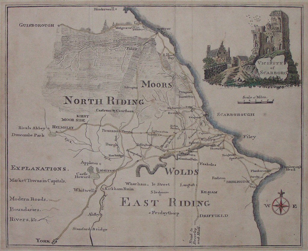
| | | 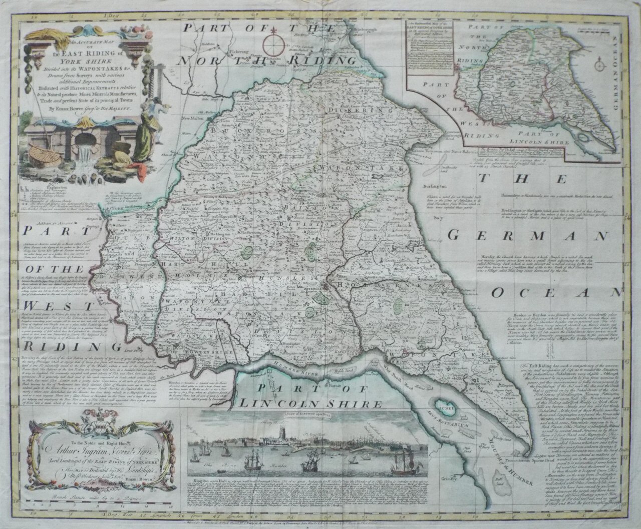 | An Accurate Map of the East Riding of York Shire Divided into its Wapontakes &c.
Ref: P/16404
Region: Yorkshire
Type: Copper
Cartographer: Bowen E
Sold |
| |
| | | 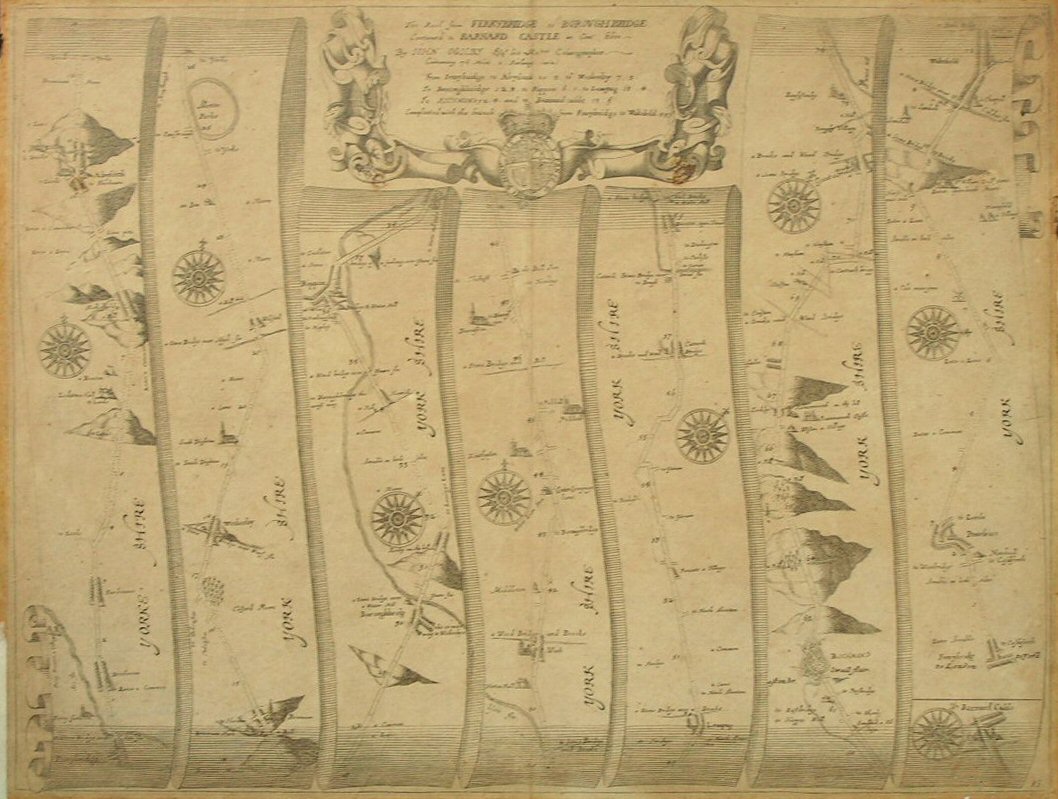 | The Road from Ferrybridge to Boroughbridge continued to Barnard Castle (Ogilby)
Ref: P/1819
Region: Yorkshire
Type: Copper
Cartographer: Ogilby J
Publisher: J Ogilby
 |
| |
| | |  | | |
| | |  | | |
| | |  | | |
| | |  | | |
| | |  | | |